
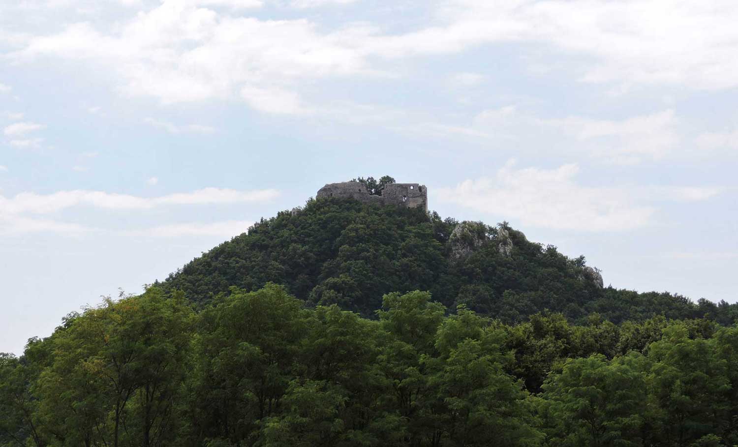
Geological structure of the Okić area
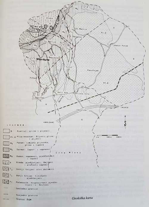
The geological structure of the Okić area comprises rocks formed across a stratigraphic range from the Upper Palaeozoic to the Holocene, corresponding to a time span of approximately 250 million years. Throughout this immense period, the area was for the most part covered by sea, to a lesser extent by brackish and freshwater lakes, and was only rarely dry land. Over the course of its long geological history, the broader Okić region was repeatedly subjected to tectonic movements, as a result of which many of its rocks — particularly the oldest — are severely folded, fractured or even displaced into new positions.
Geological investigations of the Samobor Hills and Plešivica, together with its slopes, began in the mid-19th century. In the early period, work was carried out by the Austro-Hungarian geologists Lipold (1853) and Stur (1863); among Croatian geologists, the first was Dragutin Gorjanović-Kramberger (1894), followed by Šuklje (1928–1942), Herak (1956 and 1969), and Šikić and Benček (1979).
In addition to published works, the archives of the Institute of Geological Research in Zagreb and the company INA-Naftaplin hold a large number of unpublished reports relating to oil exploration in the Karlovac Depression and to iron and copper ore prospecting in the Samobor Hills. These reports most frequently cover the area of the Okić parishes of St Mary and St Martin.
The rocks found near the hamlet of Poljanica belong to the Upper Palaeozoic. Coarse-grained sandstones predominate in the field, occasionally transitioning into fine-grained conglomerates. Black shales are frequently interbedded between the sandstone layers. These rocks were deposited in a shallow sea, where rivers and streams carried in fine gravel, which was later transformed by diagenesis into sandstones and conglomerates. During periods when no clastic material was being transported, clays were deposited, which subsequently, under the effects of pressure and temperature, became shales. The depositional environment was very extensive, as similar rocks are found between Rude and the Bregana stream, and beyond the Samobor Hills in the Marija Gorica Hills and in the areas of Ivanščica and Strahinščica.
Towards the end of the Palaeozoic, the supply of clastic material ceased, and carbonate sediments together with gypsum were deposited in the shallow sea. Fossil algae discovered in the limestones near the Bregana stream indicate that these deposits formed between 230 and 250 million years ago. The Upper Palaeozoic rocks held considerable economic importance in the Samobor Hills area, as they contained iron and copper ore as well as gypsum, all of which were exploited over many years.
In the Early Triassic the supply of clastic material increased again, resulting in the deposition of thin-bedded sandstones and shales. Small bivalves identified as Myacites fassaensis, Claraia clarai and related species have been found in these rocks at numerous locations. They occur to the south-west of Okić Castle and are typically red-brown in colour, reflecting the arid climate that prevailed at the time of their formation.
The greater part of Plešivica is built of grey Triassic dolomites. The same rocks make up several rounded hillocks in the northern part of the parish of St Martin. One such hillock forms the foundation on which Okić Castle stands. These rocks originated through sedimentation in a shallow, relatively warm sea on what is known as a "carbonate platform" — an environment comparable today to that of the Bahamas.
The dolomites of Plešivica were originally deposited as algal limestones but were subsequently converted to their present form through the process of dolomitisation. As a result, fossil remains are very rarely found within them, and their stratigraphic classification has in part been determined only approximately. It should be emphasised that these dolomites are of great importance for the water supply of the entire area. Their high porosity makes them natural collectors of rainwater, which is then channelled towards the springs. Unfortunately, dolomite is also the only mineral resource currently being exploited within the parish of St Mary. Quarrying reduces the volume of the collector mass and disrupts underground water flows, which could in turn lead to a reduction in spring capacity.
Due to the absence of natural outcrops, there is no evidence of what occurred in the broader Okić area during the Jurassic period. Based on knowledge of the geological relationships in the wider surroundings, it may be assumed that for most of the Jurassic the entire area was uplifted and no sedimentation took place.
The Cretaceous epoch is represented by rocks formed between approximately 130 and 70 million years ago. Two types of deposit occur in the area under study, each linked to distinct conditions of sedimentation.
Olive-green shales, sometimes containing interbeds of fine-grained sandstone and chert as well as blocks of basic igneous rock, belong to the older part of the Cretaceous. Today they are distributed over a relatively small area between Oštrc, Plešivica and Okić. It is assumed that they formed on the floor of a former ocean, fragments of which can today be found in northern Croatia. A notable characteristic of these rocks is that they are impermeable; where they underlie the thrust-emplaced Triassic dolomites of Plešivica, they direct the flow of groundwater. This is the reason why numerous drinking-water springs are found on the slopes of Plešivica.
The platy limestones belonging to the Upper Cretaceous are found on the southern side of Plešivica, north of the hamlet of Vlaškovec. Their formation is thought to have occurred in the conditions of a deeper, calm sea beyond the reach of any terrestrial influence. These limestones contain abundant planktonic microfossils — globotruncanids — on the basis of which their stratigraphic position has been established.
Owing to tectonic disturbance and ground cover, there is no data on what occurred during the Palaeogene and the lower part of the Neogene — that is, in the period between 70 and 25 million years ago. On the basis of knowledge of the geological structure of the Samobor Hills, combined with analysis of boreholes in the Karlovac Depression, it can be concluded that during this period a large part of north-western Croatia was covered by sea. The rocks that formed at that time have been largely eroded away. The sequence of geological events can be followed clearly only from the Upper Badenian onwards — that is, over the last 14 million years. The rocks that make up the southern slopes of Plešivica today were formed during this period.
The Upper Badenian is represented by yellow, friable limestones and yellow marls extending from Orešje to Popov Dol, with a smaller occurrence in the Podgrađe area. Remains of the alga Lithothamnium, together with fossil shells of bivalves and gastropods, are very commonly found within them. Similar bivalves and gastropods live along the shores of the Adriatic today, which allows us to conclude that, some 14 million years ago, these very slopes were a coastline of a warm sea that was, in effect, the southern margin of the Pannonian Basin. Towards the end of the Badenian, a gradual freshening of the water began, causing marine species of bivalves and gastropods to die out rapidly, while species tolerant of changes in salinity developed in their place. The boundary between the Upper Badenian and the Sarmatian is placed at this interval of salinity change.
Sarmatian deposits extend in a zone approximately 400 m wide from Vlaškovec to Bereće. These are pale-brown marls, less commonly limestones, characterised by layers a centimetre to a millimetre thick. They formed in a brackish basin in which there were no strong currents or waves. Thin sand interbeds indicate that the supply of material from the land was minimal. It follows that Plešivica, which had emerged from the sea during the Badenian, was completely submerged again during the Sarmatian, while dry land lay in the western part of the Karlovac Depression. Fossil bivalves of the species Ervilia dissita dissita, Irus gregarius and others can be found within these deposits. It is worth highlighting that fossil fish, small bivalves, twigs, and willow leaves were discovered in the road cutting between Repišće and Gonjeva. During the upper part of the Sarmatian, complete freshening of the waters took place across north-western Croatia, so that the Lower Pannonian deposits were laid down in fresh water.
Pannonian sediments form a zone approximately 2 km wide running along the southern slopes of Plešivica. The settlements of Stankovo, Repišće, Purgarija and others are built upon them today. This zone turns towards the north-east as far as Molvice. In its lower part are found platy, white, argillaceous limestones which, owing to the frequent occurrence of the gastropod Radix croatica, have been termed the Croatica beds. Also found within them are small marsh gastropods, impressions of willow leaves, and various grasses. The marsh conditions of sedimentation lasted only a very short time — some 20 to 30 m of deposits were laid down — after which a renewed connection with the Pannonian Basin was established, raising the salinity of the depositional environment. At the same time, deepening of the Karlovac Depression began, while on the southern slopes of Plešivica channels formed along which clastic material was transported from shallower to deeper parts of the basin. This gave rise to the alternating deposition of sand, marl and clay, the total thickness of which sometimes exceeds 600 m.
At the transition from the Pliocene to the Quaternary, approximately 2 million years ago, major changes took place that are significant for the whole of northern Croatia. The most important of these was the cessation of subsidence and the onset of uplift. Within this general trend of rising, different parts of the terrain moved at different rates. Plešivica and the other mountains of northern Croatia rose fastest, while the Crna Mlaka area lagged furthest behind.
Plio-Pleistocene deposits lie unconformably over older sediments. At their base there are typically limonitic sands, gravels or clays, followed by an alternation of yellow and grey sands and clays. Interbeds of carbonised wood are occasionally found among them. These sediments were deposited in a freshwater lake into which material was brought from the nearby land. They are not particularly thick, rarely exceeding 50 m. They make up the greater part of the terrain belonging to the Okić parish of St Martin.
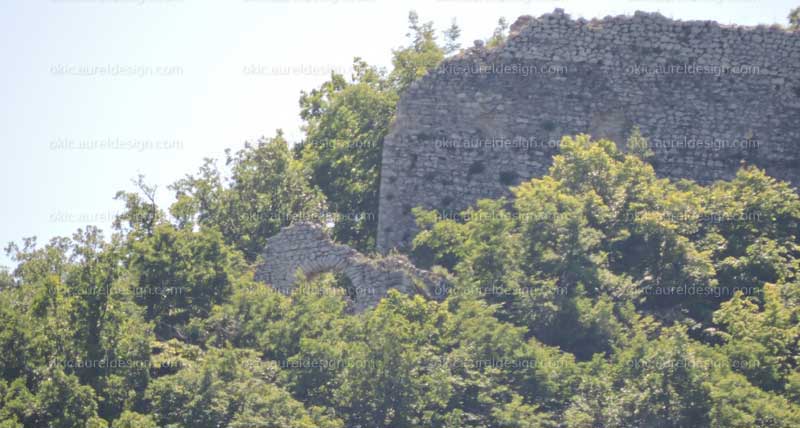
Quaternary deposits cover the greater part of the Klinča Selo parish. Because of ground cover, a lack of fossils, and probably also intense erosion, it is not entirely clear what occurred after the Plio-Pleistocene lake dried up. In our region, the Quaternary is a distinctive period in which, unlike other geological eras, a relatively long continental phase prevails. During the Quaternary, terrestrial sediments were deposited, the origin of which depended on climatic changes. During glacial periods, water circulation was reduced, and the wind brought large quantities of fine-grained sand — loess — into our region. The weathering of loess produced the greater part of the yellow loams that today cover the low hills around Klinča Selo, Zdenčina and elsewhere.
The last glaciation ended approximately ten thousand years ago, after which the Kupa and its tributaries began depositing alluvium. Based on exposed profiles in the Crna Mlaka area, it can be concluded that the River Kupa had no influence on sedimentation in that locality. At the base lies marsh loess, followed by an alternation of coarse- and fine-grained sands with lenses of gravel. In the upper part of the profile there is a very prominent layer of carbonaceous clay containing many fossil gastropods and bivalves. The rich and well-preserved fossil fauna points to frequent changes in the depositional environment, ranging from river channels and slowly flowing water to marsh conditions.
Similar sedimentation continues to this day across the wider Okić area. During heavy rains or snowmelt, streams carry gravel and coarse sand, while clay and fine sand settle in the fishponds of Crna Mlaka.